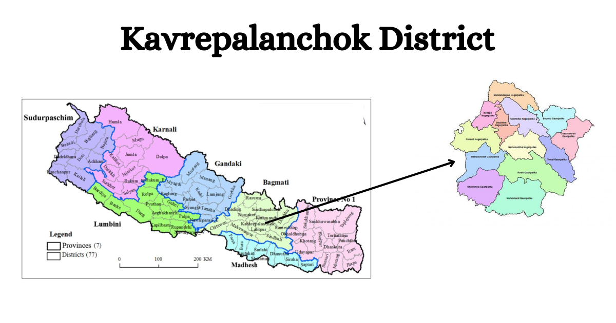
Kavre is one of the 77 districts of Nepal. Geographically, It lies in the middle hill region of Nepal. Politically, Kavre was in the former Madhyamachal development region of the Bagmati zone. Currently, It is in the Bagmati province of Nepal.
Kavre is famous for Mass Coffee Production, Buddhachitta (Religious Element), Dhulikhel Zipline, Short Route Hiking Place, & Palanchok Bhagwati Temple. Similarly, It is well known for its historical places like Panauti, Banepa & Namobuddha. The famous Tindhara waterfall is also in Kavre.
About Kavrepalanchok District
Kavre is in the eastern part of the capital Kathmandu, Nepal. The distance between Kavre & Kathmandu is 21 kilometers. The headquarters of Kavre is Dhulikhel, which is 30 kilometres distance from Kathmandu.
The total area of Kavre is 1396 square kilometres. It extends from 27°20' to 28°45' north latitude and 85°24' to 85°49' east longitude on the world map. The lowest part of Kavre is Kokhajor river. It is at a height of 280 meters from the sea level. And, the highest place in this district is Bethan Chowk. It is located at a height of 3018 meters above sea level.

Ramechhap & Dolakha is in the east of Kavre. Similarly, Kavre shares its border with Kathmandu Valley in the west. Sindhupalchok is in the northern direction of Kavre. And, Kavre connects its southern border with Sindhuli & Makawanpur.
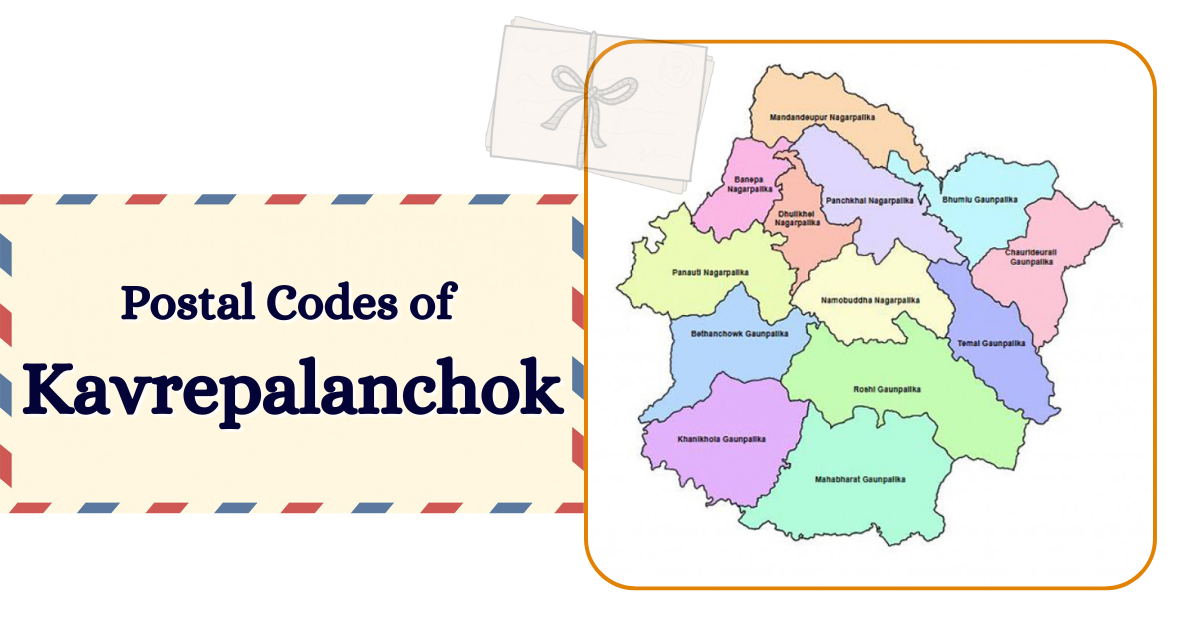
The district postal code of Kavre is 45200. There is are 12 area postal codes.
Administrative Division
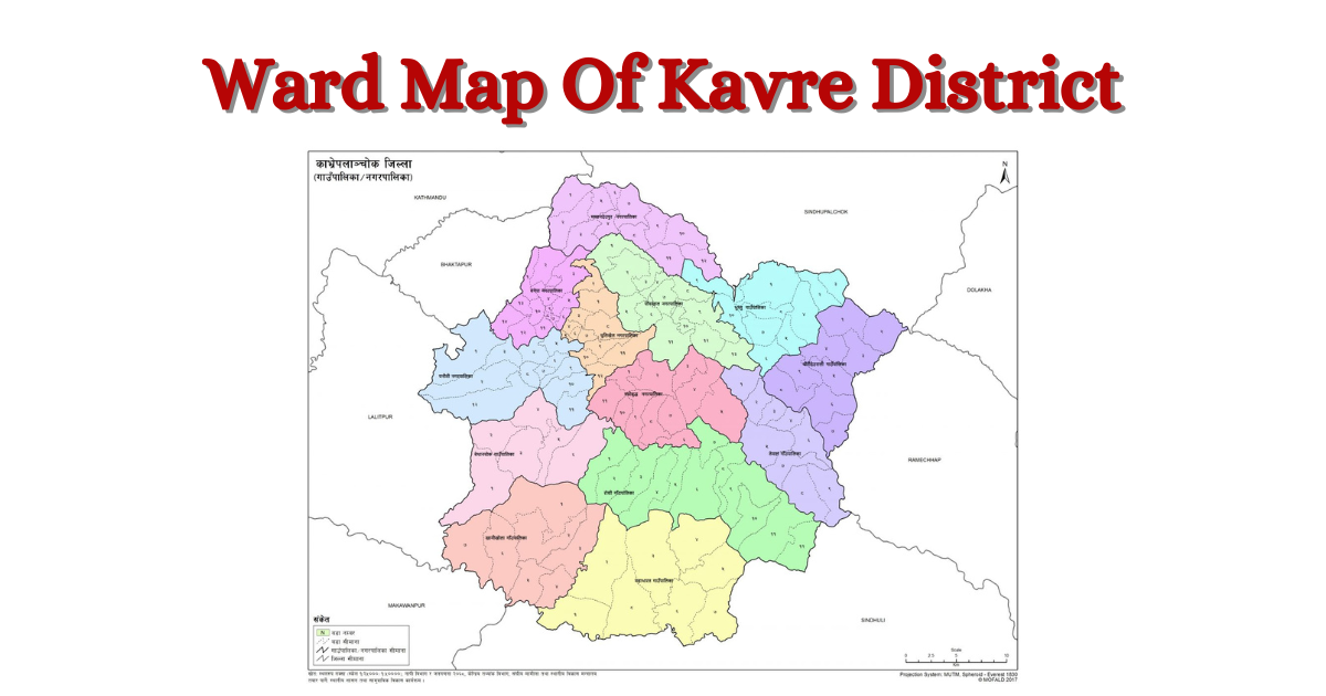
Before 2073, Kavre was divided into 5 municipalities and 75 village development committees. According to the information published in the gazette by the Government of Nepal on the 27th of Falgun 2073, Kavre has been divided into 13 local levels. Among them 6 are municipalities & 7 are rural municipalities. There are 135 ward offices in Kavre district.
Municipalities in Kavre
There are 6 municipalities in Kavre district. Here is the list of municipalities:
- Banepa Municipality
- Dhulikhel Municipality
- Mandandeupur Municipality
- Namobuddha Municipality
- Panauti Municipality
- Panchkhal Municipality
Rural Municipalities in Kavre
There are 7 rural municipalities in Kavre district. Here is the list of rural municipality in Kavre:
- Bethanchok Rural Municipality
- Bhumlu Rural Municipality
- Chauri Deurali Rural Municipality
- Khani Khola Rural Municipality
- Mahabharat Rural Municipality
- Roshi Rural Municipality
- Temal Rural Municipality
Demography: Population, Ethnicity & Religion
According to the National Census 2078, there is a population of 364039 in Kavre. This census shows a 49.1% (178909) Male & 50.9 % (185130) Female population. The population density of Kavre is 261 Persons per sq. km. The annual population growth is -0.46 %.
Population Statistics
| Total Population | 364039 |
| Population Density | 261 Persons per sq. km. |
| Sex Ratio | 96.64 Male per 100 Female |
| Annual Population Growth Rate | -0.46% |
| Total Household | 91428 |
| Literacy Rate | 75.7% |
| Average Household Size | 3.98 Persons per Household |
| Major Caste/Ethnic-groups | Tamang, Brahman, Kshetri, Newar, Magar, Bishwakarma, Mijar, Danuwar, Pariyar, etc. |
| Major Religion | Hindhu, Baudha, Christian, Islam, Kirat, etc. |
Major Ten caste/ethnic groups of Kavre
| Caste | Percentages |
|---|---|
| Tamang | 33.8% |
| Brahman | 20.1% |
| Kshetri | 13.6% |
| Newar | 13.4% |
| Magar | 4% |
| Bishwokarma | 2.6% |
| Mijar | 2.1% |
| Danuwar | 1.7% |
| Pariyar | 1.6% |
| Thakuri | 1.06% |
Religion in Kavre
| Religion | Percentage |
|---|---|
| Hindu | 63.3% |
| Bauddha | 33.9% |
| Christian | 2.1% |
| Islam/ Kirat | 0.2% |
Note: (Date Sources: National Statistics Office, National Censes 2078)
Temperature and weather
There are three types of climate, especially in the Kavre district. The area of this district is spread from 280 meters to 3018 meters above sea level. So, This district has a diversified climate. Kathajor & Bagmati River is in the southern part of Kavre, the lower part of Kavre. Fulchoki & Mahabharat hill range is the higher part of Kavre. Different parts of Kavre have experienced a variety of temperatures & weather.
Sub Tropical
A semi-tropical climate extends up to 1000 meters from sea level. Sunkoshi, Roshi river bank, and Panchkhaal valley of Kavre district are in this area. Similarly, Mahadevasthan, Bhakundeveshi, Mangaltar, Taldhunga, Shikhar Ambote, and Gokule areas are included in this area. The temperature in this region ranges from 5 to 34 degrees Celsius.
Mild Temperature
A Mild temperate climate exists at altitudes between 1000 meters and 2000 meters. According to the geographical structure of Kavre district, this climate prevails in many places, including Banepa, Panauti, and other areas. The temperature ranges from 2 to 28 degrees Celsius here.
Cool Temperature
Cool temperature climate exists at altitudes up to 2000 meters from sea level. Chaubas, Nagarkot, Pokhari Narayansthan, Bethanchok, Mahabharat range of Kavre district exist cool temperature. The temperature ranges from 0 to 18 degrees Celsius.
Educational Institutions
Kavre district lies in the central hilly area of Nepal. Urbanization has developed in this district's areas touched by the Araniko Highway and BP Highway.
Education Institutions
Various government and private educational institutions are operating in the localities of Kavre district. According to the 2073 report of the District Education Office, there were 685 public and private schools in Kavre including primary and secondary schools.
According to the district profile of 2074, there are 496 child development centers, 1 university, 21 campuses, 34 community study centers, 25 monasteries in Kavre.
Literacy Rate
According to the latest reports, the number of public schools in Kavre is decreasing. The number of private schools in urban areas is also increasing. Many public schools have been closed due to the lack of people in the villages due to migration.
According to National Census 2078, The literacy rate of Kavre is 76.2%. There are 83.6% of male literacy & 69.4 % female literacy rate in Kavre.
Health Institution
There are various types of private & public health institutions in the Kavre district. The famous Dhulikhel Hospital lies in the Kavre district. Here is the minimum one health post on each ward. According to district police, there are 4 primary hospitals, 25 health posts, and 64 sub-health posts. Similarly, there are 306 village clinics in the Kavre.
Forest
The total forest area of Kavre is 77552 hector. As of 2074, there are 564 community forests in Kavre. There are various types of plants, herbs, and animals in the forests of Kavre district. Different types of forests are religious forests, and private forests in the Kavre district.
Rivers & Lakes
There are 492 rivers, streams, and waterfalls in Kavre. The main rivers are Indrawati, Sunkoshi, Roshi, Kokhajor, and Khani Khola. These rivers flow through different watersheds. The main lakes of Kavre are Tarakhse Pokhari, Narayan Pokhari, Deupokhari, Mahadev Pokhari etc. Similarly, Tindhara and Shashipani are the main waterfalls in Kavre.
Historical, religious and tourist places
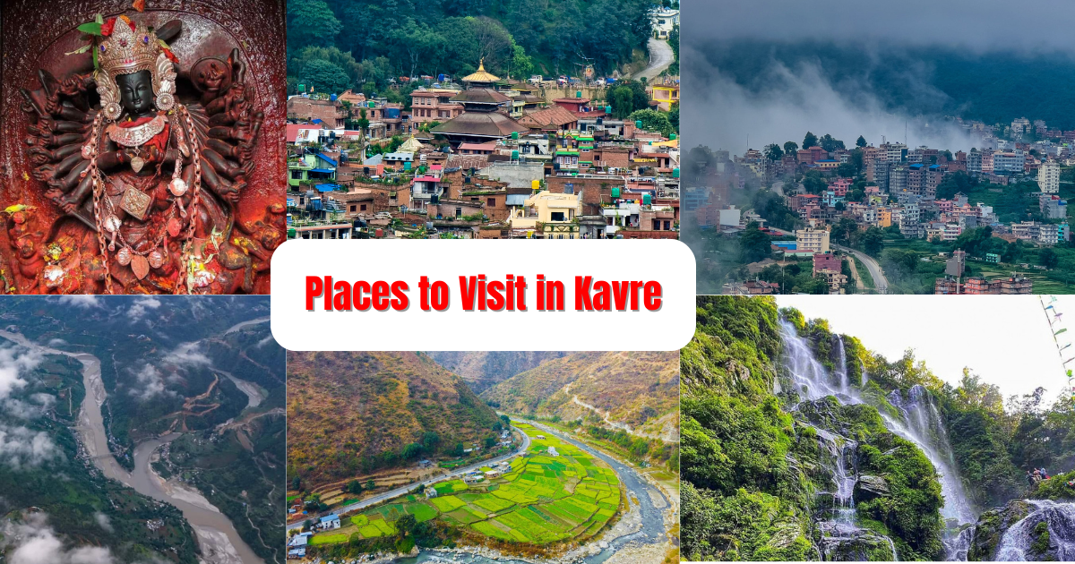
Kavre district is famous for local product, original culture, beautiful natural places, short circuit hiking, and more. There are many historical, religious & tourists places in Kavre. Palanchok Bhagwati, Chandeshwori, Namobuddha, Gorakhnath, Nala Bhagwati etc. are the religiou places of Kavre. Banepa, Panauti, Dhulikhe is the histroica places in Kavre. Similarly, Tindhara waterfall, Tarakhase, Bethanchowk, Banthali, Tinalm Dhungkharka, Panchkhel, Dolalghat etc. are the tourist places in Kavre.

Market (Bazar) and Commercial Center
Kavre district is one of the commercial centre of Nepal. There are many large market/ bazar to trade & commerce. Banepa, Dhulikhel, Panchkhal, are the main market of Kavre. Similarly, Panauti, Dolalghat, Mangaltar, Dhungkharka, Balthali, Ghartichhap, Machhegaon, Bhakundebesi, Patlekhet etc. are another market places of Kavre.
Ethnic groups and Caste
Kavre is the home of variety of ethnic groups & caste. Mainly, Tamang, Brahman, Kshetri, Newar, Magar, Bishwakarma, Danuwar, Pariyar and others caste are living in different places of Kavre. Particular Ethnic groups have their own language, arts, culture.
Major Highways
Araniko highways & BP highways are the major road connection in Kavre. There are dense human settlements around these highways spread in Kavre district. This highway is the backbone for development of Kavre district.
Places to visit in Kavre
Kavrepalanchok is the home of diverse nature & places. There are many places to visit in Kavre. Famous Palanchok Bhagwati is a religious place in Kavre. Similarly, Tindhara, Dhulikhel, Namobuddha etc. are another attraction of Kavre. The list is:
- Dhulikhel
- Tindhara Waterfall
- Palanchok
- Panauti
- Namobuddha
- Banthali
- Dolalghat
- Chandeshwori
- Banepa
- Panchkhal
- Bethanchowk
- Kathmandu University
- Temal
- Khanikhola
- and More.


