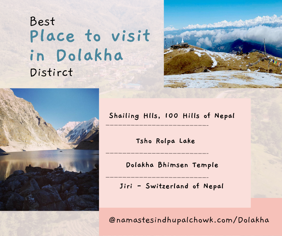
Dolakha is one of the 77 districts of Nepal. It lies in the middle of the Himalayan region of Nepal. This district is famous for its natural, historical, and cultural attractions. Furthermore, Jiri, Charikot, Kalinchok, Kuri village, Dolakha Bhimeshwor, and Kalinchok Darsan Cable Car are famous places in Dolakha.
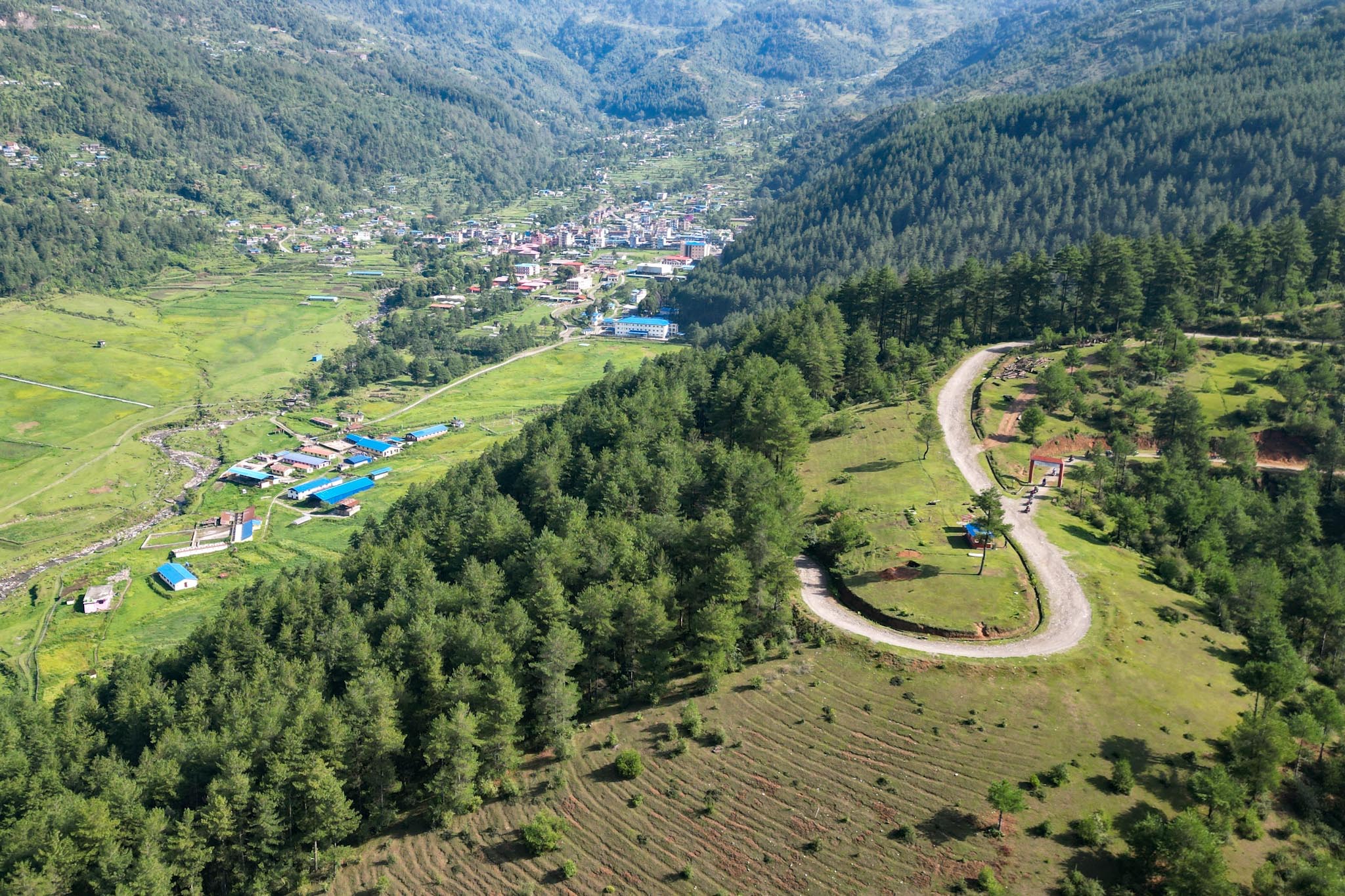
Dolakha is about 133 km northeast of Kathmandu. Moreover, It takes a 4-5 hour bus journey to reach its headquarters in Charikot. It is at an elevation of 1,554 m above sea level. Besides, The majority of people in Dolakha follow Hinduism and the predominant ethnic group is Newar.
Dolakha is popular for its natural hiking trails, seasonal snow-clad hills, religious sites, and many more. Additionally, Dolakha has the famous Dolakha Bhimeshwor Temple which is the centre of the Hindu faith.
About Dolakha District, Bagmati, Nepal
Geographically, Dolakha district extends from 27°28' to 28°00' north latitude and 85°50' to 86°32' east longitude. The total area of Dolakha is 2191 square kilometres (846 square miles).
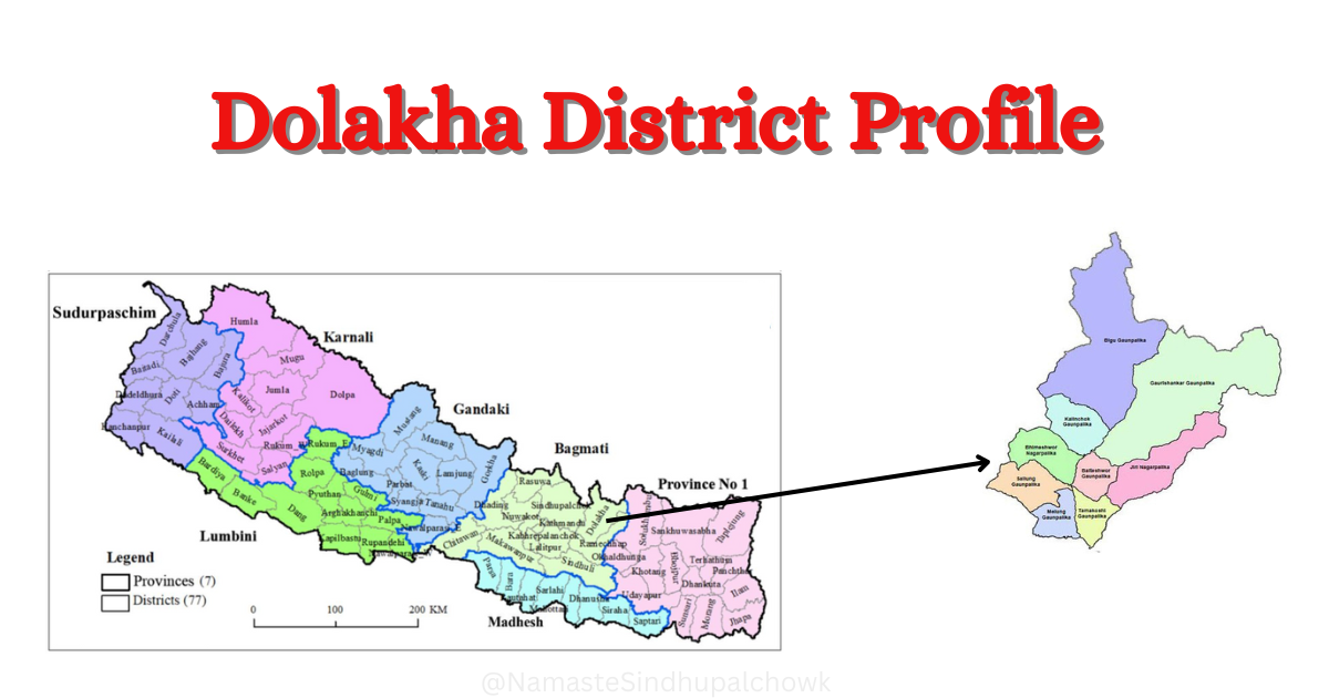
Solukhumbu and Ramechhap are on the eastern border of Dolakha. The western border is connected with Sindhupalchowk. Similarly, Dolakha shares its northern border with China. Additionally, the Ramechhap district is in the southern part of Dolakha. The headquarters of Dolakha is Charikot. It spreads from 762 meters to 7134 meters above sea level.
Sitali is the lowest land in the Dolakha district. It is 762 meters above sea level. Moreover, Gaurishankar Himal is the highest peak in Dolakha. It is 7134 meters from sea level.
45500 is the district postal code of Dolakha. There are 10 area postal code in Dolakha.
Geographical Structure of Dolakha
Dolakha is the Himalayan district of Nepal. The majority of the land is covered by high hills & mountains in Dolakha. There is 10% of flat land with having river, hill station, and river bank. Based on topography, the high Himalayan area covers 35 % land of Dolakha. Similarly, the High hilly area covers 40% land of the total area of Dolakha. Moreover, 25% of the land of Dolakha spread in the Middle hilly region. Dolakha is the district in the mountain region. So, 70% of the land in this district is more than 30 degrees steep.
History of Dolakha
Dolakha is the ancient city of Nepal. It has a long historical aspect. Since ancient times, Dolakha has its own social, economic, cultural, religious and political identity. There are many legends about the naming of the Dolakha district. According to the Dolakha district profile of 2072, there are mainly two legends in circulation.
- "Do" means "stone" in Tibetan language. Similarly, "La" means temple. And "kha" means "house". Due to the abundance of houses and temples made of stone and mud, this area is named Dolakha.
Dolakha inhabited since the reign of the Kirants. It is believed that after the opening of the trade route to Nepal and Tibet through Lama Bagar in Dolakha, the Newars went from Bhaktapur and settled. At this time, Dolakha was a separate state. At that time Dudh Koshi was in the east of Dolakha and Dolalghat was in the west. Similarly, Tibet was in the north and Tirahu state was in the south. In 1811, Dolakha State merged into Nepal state.
Until the year 2018, Dolakha was in the number 2 administrative unit. In 2018 BS, Dolakha was established as a district. After being established as a district, in 2024, district-level offices including a court, mail, police, post office, and health office established in Dolakha.
Administration Division of Dolakha
Before 2073, There was 2 municipalities & 53 village development committees. According to the information published in the gazette by the Government of Nepal on the 27th of Falgun 2073, Dolakha has been divided into nine local levels. Among them 2 are municipalities & 7 are rural municipalities. Now, there are 74 wards in Dolakha district.
Municipalities in Dolakha
There are two municipalities in Dolakha district. Here is the list of municipalities:
Rural Municipalities in Dolakha
There are seven rural municipalities in Dolakha district. Here is the list of rural municipalities:
- Bigu Rural Municipality
- Melung Rural Municipality
- Gaurishankar Rural Municipality
- Tamakoshi Rural Municipality
- Kalinchok Rural Municipality
- Baiteshwor Rural Municipality
- Sailung Rural Municipality
Demography: Population, Ethnicity & Religion
According to National Census 2078, there are 172767 total population in Dolakha district. There is about 19 % (83720) of the male population. Similarly, there is 51% (89047) of the female population. Additionally, The population density of Dolakha is 78.85 persons per square kilometre. Furthermore, the annual population growth is -0.73%. This means that the population of Dolakha gradually decreased compared to 2011.
Population Statistics
Here is the population statistics of Dolakha:
| Total Population | 172767 |
| Population Density | 78 person per square KM |
| Annual Population Growth | -0.73% |
| Total Household | 49538 |
| Literacy | |
| Major Castes | Kshetri, Tamang, Thami, Newar, Brahman, Sherpa, Bishwakarma, Jirel etc. |
| Major Religions | Hindu, Bauddha, Islam, Kirat etc. |
Educational Institutions: Schools, Colleges, & Campus
Dolakha district has various private & public schools, colleges, & campuses. According to the District Profile, There are about 367 community-based schools & colleges in Dolakha. Similarly, there are 11 campuses in this district. Moreover, there are about 290 child development centres in Dolakha. More than 10 educational institutions are operating as religious schools in Dolakha. As we know, many technical schools and nursing colleges are also in the Dolakha.
Health Institution: Health Post & Hospitals
Dolakha is the Himalayan district located in Bagmati province of Nepal. There various public & private health institution that provide quality health services in Dolakha. Normally, most of the health institution provides all types of basic medical or health services.
There are one district hospital & 2 primary health center in Dolakha. Additionally, there is one district Ayurded hospital. Similarly, Each & every ward have at least one health post in Dolakha district. Furthermore, government operates various village clinic, sub-health post in Dolakha.
Chyoralpa nursing college, Jiri technical school, Dolakha community hospital is the major health related college in Dolakha.
Forest in Dolakha
The total area of forest in Dolakha is about 136464 hectors. Mainly, Gaurishankar conservation area covers all the forest of Dolakha. There are more that 400 community forest and more than 150 Kabuliyati forest in Dolakha. Additionally, it has more than one religious forest.
According to the altitude, there are various types of forests in Dolakha. These are Temperate Evergreen Forests, Deciduous Seasonal Forests, Evergreen Angular Forests, Deciduous Forests, and Cold Desert Forests. Many types of animals, plants & herbals are found in this forest.
Temperature & Weather of Dolakha
Especially, There are four types of climate in the Dolakha district. It spreads from 762 meters to 7134 meters above sea level. Due to the variation of geographical altitude, there are the variety of weather.
Warm Temperate Climate: This climate is found at an altitude of up to 2100 meters above sea level. Around the Tamakoshi River area, this climate is found.
Cool Temperate Climate: This climate is found at 2100 meters to 3300 meters above sea level. The temperature reaches 0 degrees in winter in this region. Similarly, summer temperatures range from 15 to 20 degrees Celsius. Annual rainfall in this area is up to 50 cm. It includes Jiri, Kharidunga, Charikot, Kalinchok, Shailung etc.
Cold climate: Lakali climate is found especially in the Himalayan region. This climate is at an altitude of 3300 meters to 5000 meters. In winter, the temperature here is minus. Annual average rainfall is up to 30 cm. It includes Lamabagar, Gaurishankar, Chchhorolpa, Shyama, Bigu etc.
Tundra Climate: This climate is found above 5000 meters. It snows in this region for twelve months. It includes Gaurishankar Himal, Tasi Bhangyang etc.
Historical, Religious & Tourist Places in Dolakha
Dolakha is the home to historical, religious & tourist places. Dolakha Bhimsen, Kalinchok Bhagwati, Tripurasundari Charighyang Gumba, and Tasi Gumba are the religious places in Dolakha. Similarly, Shailung, Deudhunga, Jiri, Charikot, Lamabagar, and Bigu are the historical & tourist places in Dolakha. There are many other places. Furthermore, This district is famous for religious, historical & tourist places. Other famous places of Dolakha are Kharidunga, Chchhorolpa, Taksar etc. There are various trekking routes, hiking routes and more.
Major Market (Bazar) & Commerical Center in Dolakha
Dolakha is one of the commercial center in Nepal. Majorly, Charikot, Jiri, Kuri, Lamabagar, Singati, Shailung are the market in Dolakha.