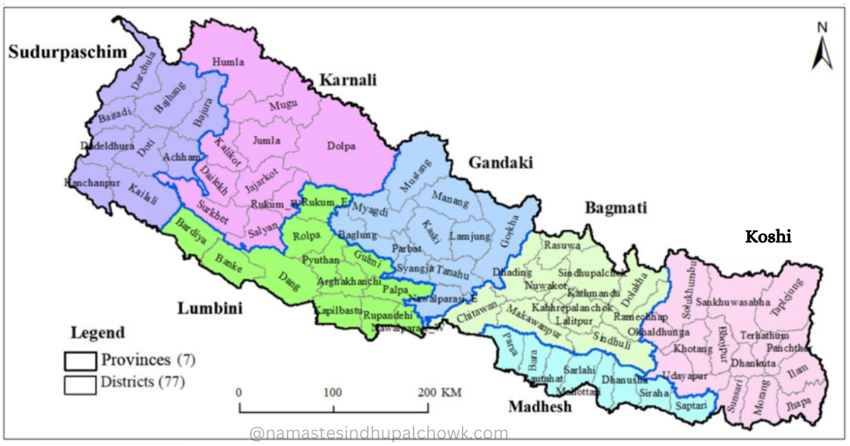
Jugal rural municipality is one of 9 rural municipalities in Sindhupalchok district, which is located north of Kathmandu, the capital of Nepal. Selang, Gumba, Golche, Baramchi, Hagam and Pangtang Village Development Committees were adjusted and Jugal Rural Municipality was formed. Currently, there are 7 ward offices in this rural municipality. Spread over a total area of 592 square kilometres, this rural municipality is named after Jugal Himal. Spread in the Himalayas, this rural municipality is the largest local body in the Sindhupalchok district based on its area. As it is spread over the Himalayas, the geographical location here is difficult and complex. Also, it is very cold at higher altitudes. This rural municipality extends from 300 meters to 7080 meters above sea level.
The eastern border of Jugal Rural Municipality is connected with Bahrabise Municipality and Bhotekoshi Rural Municipality. Similarly, the western border of Panch Pokhari is connected with Thangpal Rural Municipality and Indrawati Rural Municipality, the northern border with Rasuwa and Tibet, the southern border with Chautara Sangachok Gadhi municipality and Balephi village municipality.
Jugal Rural Municipality : No. of Wards
- Ward No. 1, Selang
- Ward No. 2, Golche
- Ward No. 3, Gumba
- Ward No. 4, Pangtang
- Ward No. 5, Baramchi
- Ward No. 6, Hagam
- Ward No. 7, Yanglakot
Population of Jugal Rural Municipality
According to the year 2068, the total population of the rural municipality was 19223. According to the latest census in 2078, there is a total population of 19148, of which 9657 are males and 9491 are females. There are a total of 4549 census houses and 4698 families. In the Sindhupalchok district, the size of the population is decreasing recently. Therefore, the size of the population here is also decreasing. Especially the number of people leaving the village and moving to the city in search of opportunities is increasing recently.
Tamang, Newar, Sherpa, Magar, Gurung etc. are the main castes living here. People here mainly follow Buddhism, Hinduism, Christianity etc. And Tamang, Nepali, Sherpa, Newari are the native languages spoken here.
Educational Institutions
This municipality, located in the remote part of the district, is progressing on average in education. After the earthquake of the year 2072, the physical structures of the public schools here have become state-of-the-art. After the arrival of the local government, the physical structure of most of the schools here has been modernized with the help of various donors and proper budget arrangements.
There are 22 child development centers, 25 primary schools, 9 basic schools, and 9 secondary schools in this village municipality.
According to the year 2068, the total literacy rate here was 49. 91 percent, of which 42 .91 percent were women and 57 .04 percent were men. According to the year 2078, the literacy rate here has not been published.
Health Institution
The geographical difficulty is the main challenge for the development of Jugal Rural Municipality spread in the high Himalayan region of the district. Fighting geographical difficulties, the local government has been trying to provide more health services to villages. Due to the lack of health institutions and public awareness, the health services here were not very effective until some time ago, but recently, even the health institutions here provide basic to moderate health care. The health institutions here have been providing health services by using some modern equipment as possible. There are health posts in almost all the wards of this municipality, which provide basic to medium health services.
Gumba health post, Pangtang health post, Hagam health post, Baramchi health post, Selang health post, Golche health post are the community health institutions of Jugal Rural Municipality. Apart from this, other types of health institutions are also developing recently. The complicated patients here are brought to District Hospital Chautara (headquarters) and if they cannot be treated there, they are brought to Dhulikhel or capital hospitals.
Cultivable Land and Livelihood
Jugal village municipality is spread in the high Himalayan region of Sindhupalchok district. About 5898 hectares of the total area of the village is under cultivation. Geographically difficult and many areas are in direct contact with the mountains, there is not much cultivation. However, in the lower part of the rural municipality, various food crops, cash crops, and some amount of vegetable cultivation are also planted. Apart from agriculture, many people here keep animals. Cows, goats, chauri, etc. are the animals raised here.
Apart from these, recently, the village municipality has been providing various types of skills and training to the people here. The village municipality has been providing agricultural and animal husbandry development programs, various trainings and skills aimed at women under the livelihood program. Similarly, by providing tourism and non-agricultural trainings, it has helped the local people in their livelihood. Herb trade is also the main source of income.
Forest
This municipality, which is very beautiful and has immense potential in terms of nature, has an area of about 197.8 square kilometres covered by forests. In other words, 33 per cent of the land is covered with forests. Some parts of the forests here belong to Gauri Shankar Conservation Area and Langtang National Park. According to some recent data, there are 21 community forests and 104 confessional forests.
Religious and Tourism places
Jugal village municipality itself is a wonderful place. This municipality, which has various potentials including water resources and tourism, is an attractive centre for internal and external tourism. There are more than 10 small and large hydropower projects in operation, and there are many types of tourism here. There are many mountains, rivers, and religious places within this municipality, which are standing happily in the arms of Jugal Him Srinkhala. The mountains under the Jugal Ice range are the main attraction here. Balefi Hydro Power, Bhotekoshi, Domang Pond, Pangtang, Chanaute, Baramchi are the commercial and tourist areas here.
